
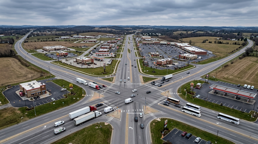
Anyone who has driven the run between Louisville and Nashville knows the stretch. Interstate 65 carries touring vans, festival traffic and freight in roughly equal measure, and about halfway down it passes Elizabethtown, where the interstate meets a network of two-lane roads that were never designed for the volume now using them.
That meeting point is where the crash reports cluster. Not on the interstate itself, which is engineered for speed, but at the junctions where highway-speed traffic meets local roads.
Intersections Concentrate Risk Out of Proportion to Their Size
Intersections occupy a tiny fraction of the road network and account for an enormous share of the harm.
Federal safety research puts roughly one quarter of traffic fatalities and about half of all traffic injuries at intersections, and more than half of combined fatal and injury crashes at or near them. They also account for almost 20 percent of speeding-related fatal crashes.
The rural pattern is different and worse
The detail that matters for a county like Hardin is where those deaths actually happen. Federal guidance for local and rural road owners reports that rural road intersections account for roughly 40 percent of intersection-related fatalities nationally, and that more than 80 percent of those occur at unsignalized intersections.
That is the opposite of what most people assume. The dangerous junction is usually not the busy signalized one downtown. It is the stop-controlled crossing on a road where the through traffic is moving at 55 and nobody is required to slow down.
Why Elizabethtown’s Geometry Produces Volume
The city sits where several route types converge, and each brings a different driver expectation to the same pavement.
Interstate traffic exits at highway speed and meets arterial roads carrying local trips. US routes that once functioned as the main road between towns now run through commercial frontage with dozens of driveways. Parkway connections feed traffic that has been travelling uninterrupted for an hour.
The left turn does most of the damage
Across road types, the unprotected left turn across oncoming traffic is the movement that generates the severe crashes. A driver has to judge the speed and distance of an approaching vehicle, and the judgment gets harder as the approach speed rises.
At a rural intersection where the through road carries fast traffic and the turning driver is stopped, the gap that looks acceptable is frequently not. The resulting collision is an angle impact, which produces the worst injuries because the side of a vehicle has far less structure than the front.
The same federal analysis puts numbers on it: every 100 reported angle crashes at unsignalized intersections yields roughly one to three fatalities and five to fifteen serious injuries.
Commercial driveways behave like intersections
Retail corridors add conflict points that never appear on an intersection map. Every entrance is a place where a vehicle can turn across traffic, and drivers approaching them are looking for a store rather than for a car.
The count matters more than any single driveway. A mile of frontage with thirty access points asks a driver to monitor thirty potential conflicts while also reading signals and signs, and attention does not scale that way.
Unfamiliar drivers make different errors
Traffic passing through on a long trip behaves differently from local traffic. Someone following a navigation prompt makes late lane changes, brakes for turns they nearly missed, and has no memory of which approach has poor visibility.
On a corridor that carries a high share of through traffic, a meaningful portion of drivers at any given junction are seeing it for the first time.
How the State Decides Which Locations Get Fixed
Kentucky prioritizes safety spending using crash data rather than complaints, which is why a junction that locals consider obviously dangerous can go years without changes.
The Office of Highway Safety administers the state’s safety programs and its strategic plan. Location-level crash records feed a state transportation data portal that supports the analysis behind project selection.
Why the report you file matters
Those datasets are built from crash reports. The coding on an individual report, including whether the crash is classified as intersection-related and what contributing factors are recorded, is what eventually shows up as a pattern.
A crash that gets miscoded as a non-intersection event on a road segment does not contribute to the case for fixing the junction where it actually happened.
What Changes at a Bad Intersection, and What Does Not
Engineering fixes work, and they are incremental. Adding a dedicated turn lane removes the stopped vehicle from the through lane. Improving sight distance by clearing vegetation or regrading an approach gives drivers the information they need earlier. Converting to a roundabout removes the angle conflict entirely by making every movement a merge.
What does not work is expecting behavior to change on its own at a location whose design is producing the errors. When the same crash keeps happening in the same place, the cause is usually geometry rather than character.
What to Do If It Happens to You There
Photograph the approach, not just the vehicles. Sight lines, signage, vegetation and where each vehicle came to rest are the details that explain why the collision occurred, and they are gone by the time anyone returns.
Note the exact location with enough precision to identify the intersection rather than the general road, because that distinction determines how the crash is coded.
Get the report number before leaving, and read the report when it issues. Errors in the narrative and diagram are common and much easier to address early than months later. For drivers passing through on a tour or a haul, working a practice that is actually local, such as The Fleck Firm, matters more than usual, since the case will be handled under Kentucky rules regardless of where the vehicle is registered.