Most agricultural surveys fail before the props even spin. Relying on consumer-grade mapping drones over dense crop canopies almost guarantees corrupted telemetry and misaligned orthomosaics, as standard GPS configurations easily lose lock under heavy foliage. Precision agriculture demands hardware engineered to conquer this environmental interference.
Deploying a massive 58.3 kg industrial platform like the DJI Agras T100 Sprayer Drone for aerial mapping requires transitioning from fragile consumer photogrammetry logic to heavy-payload industrial telemetry standards. By leveraging its robust commercial-grade positioning systems, this powerhouse bridges the gap between raw spraying capacity and pinpoint surveying accuracy.
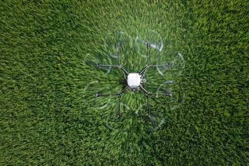
Photo from Pixabay.com
Payload Integration for Precision Mapping
Capturing usable agricultural data requires more than a simple camera payload. Heavy agricultural UAVs carry sophisticated arrays that demand perfect gimbal stabilization and constant power delivery. Managing these power requirements requires deep knowledge of lithium polymer battery discharge rates.
Multispectral Sensor Calibration
Healthy plants reflect near-infrared light differently from stressed plants. Capturing this data requires multispectral sensors calibrated to exact ambient light conditions. A slight voltage drop from the ESC can cause gimbal micro vibrations.
Those vibrations ruin the ground sample distance. Calibrating the incident light sensor before every flight prevents false NDVI readings caused by passing clouds. Consistency is everything. Without proper calibration, a shadow cast by a cloud might be falsely interpreted as a massive crop disease outbreak by your analytical software.
Omnidirectional Radar Implementation
Traditional optical avoidance systems fail over featureless fields of uniform green crops. Radar penetrates dust and darkness. Active phased array radar maps the topography in real time, adjusting altitude to maintain a consistent height above the crop canopy.
Consistent height ensures the photogrammetry software stitches the images without distortion. Maintaining a perfectly level altitude above ground level prevents scale variations within the final orthomosaic map.
Beyond Standard Positioning Hardware
Standard drones drift when surveying sprawling farmland. The sheer scale of commercial agriculture introduces magnetic interference and multipath errors that standard flight controllers cannot handle. Integrating the DJI Agras T100 Sprayer Drone from a specialized provider like Talos Drones requires absolute precision, relying on advanced telemetry configurations to ensure exact survey overlap.
That exactness prevents skipped rows and uneven data collection. Maintaining accurate coordinates requires robust data links. Integrating RTK processing, via a local D-RTK 2 mobile station or a regional NTRIP network caster, dynamically injects differential corrections into each image’s EXIF metadata. You get centimeter-level accuracy even when flying over rolling terrain. This hardware relies on multiband GNSS receivers that maintain strong connections despite dense atmospheric conditions and localized RF interference from farming equipment.
The High Megapixel Surveying Myth
A persistent misconception in drone mapping is that higher megapixels guarantee accuracy, a myth relevant to the DJI Agras T100 Sprayer Drone. Packing more pixels onto a tiny sensor introduces noise and reduces dynamic range. Sensor size dictates light capture. A 20-megapixel 4/3-inch or full-frame sensor utilizing a mechanical global shutter completely outclasses a 48-megapixel 1/2-inch mobile Quad-Bayer sensor by minimizing low-light ISO noise and rolling shutter distortion.
Photogrammetry relies on crisp edges and high contrast to find tie points between overlapping photos. Blurry images are useless. Prioritize a mechanical shutter over an electronic rolling shutter to eliminate the jello effect during fast forward flight. Electronic shutters warp moving subjects, destroying the geometric accuracy of your final map.
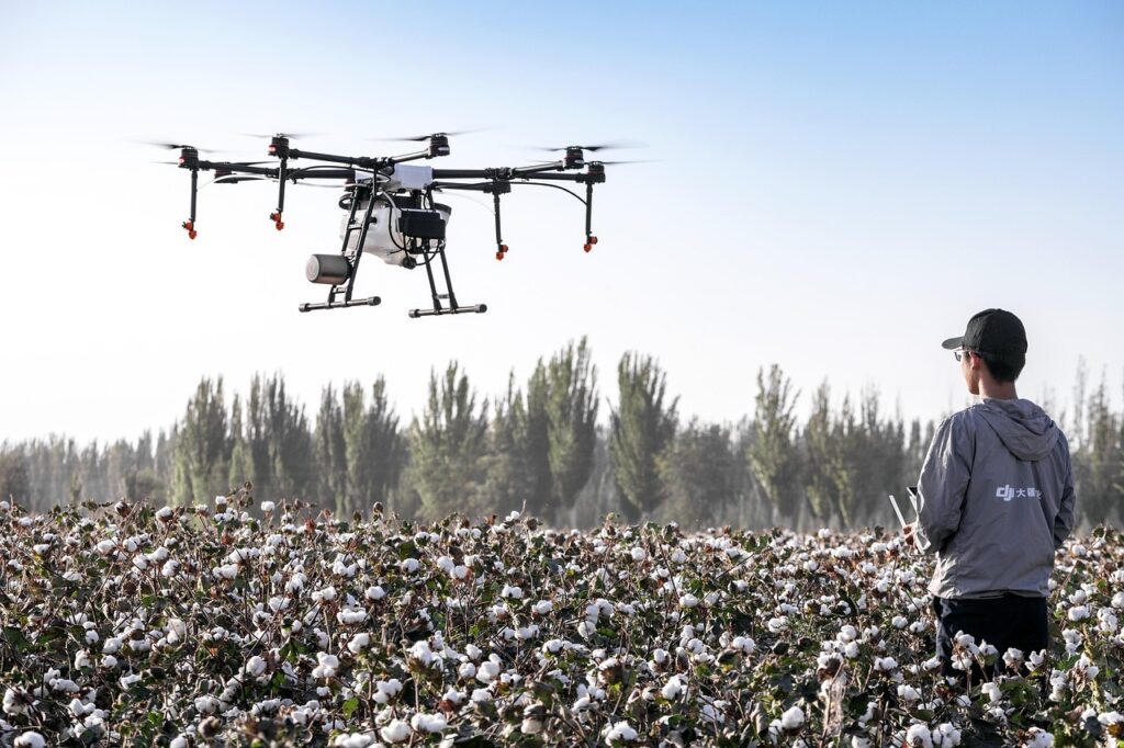
Photo from Pixabay.com
Field Workflows and Regulatory Compliance
Operational efficiency determines profitability. Large agricultural drones drain batteries quickly under heavy payloads. Cold weather reduces battery voltage, triggering premature return to home sequences. Keep batteries in insulated cases until exactly when they are needed.
Plan flight paths perpendicular to the wind direction. Crosswind flight paths force the flight controller to constantly pitch into the wind, wasting battery power and altering the camera angle. Optimizing autonomous flight paths around precise field boundaries reduces high-torque deceleration spikes during crosswind turns, preserving critical battery voltage.
Flying heavy agricultural platforms requires strict adherence to aviation regulations. Because the unladen DJI Agras T100 Sprayer Drone airframe weighs over 55 pounds, operators conducting mapping missions must secure an FAA Section 44807 heavy drone exemption under Part 107, rather than a Part 137 dispensing certificate, which strictly governs active chemical applications. Operators must comply with civil aviation guidelines regarding weight limits and restricted airspace.
Ensure firmware updates are completed on a stable WiFi network at the office. Field updates over weak cellular hotspots often corrupt firmware geofencing data, grounding the aircraft for the day. You never want to troubleshoot software while standing in a dusty field.
Questions About Agras Land Surveying
How do you prevent magnetic interference when mapping with the DJI Agras T100 Sprayer Drone?
Deploy the RTK ground station to bypass compass vulnerabilities. Calibrate your equipment fifty feet away from transport trucks and generators to secure clean, uncorrupted mapping telemetry.
What are the optimal mapping overlap settings for the DJI Agras T100 Sprayer Drone?
Set a minimum of eighty percent forward and seventy percent side overlap in DJI Terra. This allows the T100 software to accurately reconstruct featureless, dense crop canopies.
How do high winds affect the DJI Agras T100 Sprayer Drone’s volumetric calculations?
High winds shake the crop canopy, causing photogrammetry software to miscalculate elevations. For the heavy T100, restrict mapping flights to under twelve miles per hour to preserve battery voltage.
How do you avoid firmware geofencing errors on the DJI Agras T100 Sprayer Drone?
Always download updates and boundary data packages using a stable office internet via the DJI SmartFarm app. Field updates over weak cellular networks corrupt geofencing data, grounding the aircraft.

