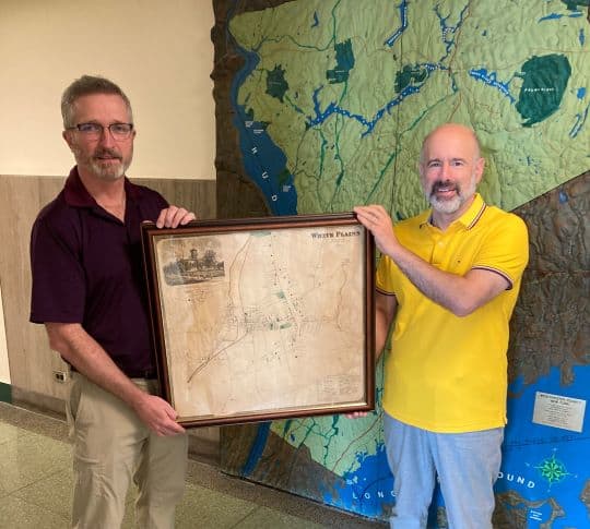
When Sandra Borthwick purchased her Brevard County, Florida house she never thought it would hold a key historic artifact. While moving into her new home, the Sunshine State resident discovered in her attic an 1867 map of White Plains, NY. The ancient chart displays the then village streets, lists properties by owner’s name and outlines building images on each lot.
Ms. Borthwick strongly felt the vintage record should return to its hometown. She contacted Bill Brady, Westchester County Chief Planner who made arraignments with John Vorperian, President, White Plains Historical Society for that non-profit organization to take possession of the antique map.
Brady and Vorperian, both White Plains residents, believe the 24” x 24” print is a unique piece of Americana. Vorperian, said “Two years after the South surrendered, the Jacob Purdy House (Washington’s Headquarters), is not at its present site, Park Avenue, but Spring Street nearer the Bronx River.”
The Society President observed some Mansions were larger than the Courthouse. To which Brady stated “I could spend hours looking at this map.”


